A Journey into Mexico's Earth Processes
This page will be dedicated to all the content I will provide for weeks, showcasing various earth processes in Mexico.
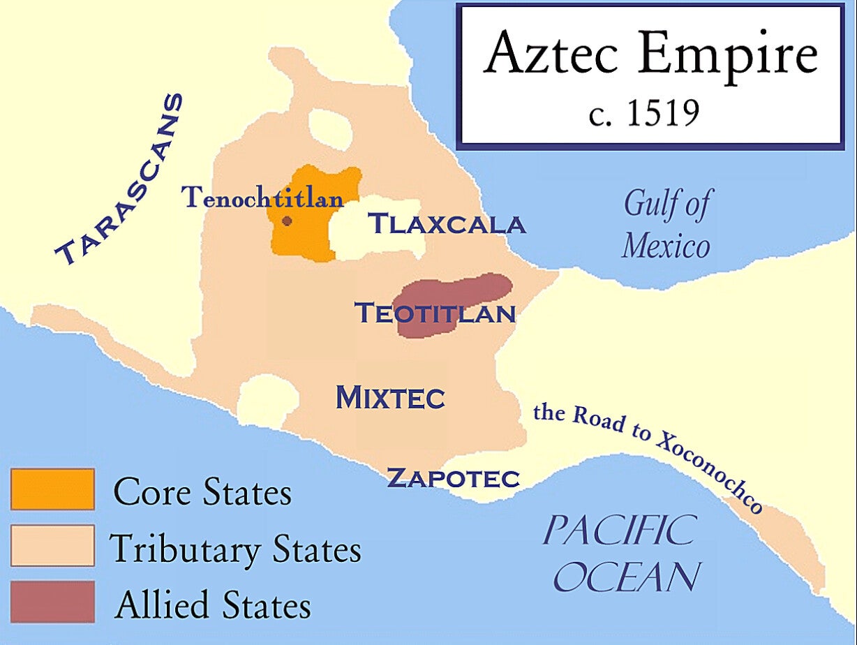
Ancient Map of the Aztec Empire (c. 1519)
This map highlights the impressive reach of the Aztec Empire just before Spanish colonization. Centered around Tenochtitlan (modern-day Mexico City), the empire stretched across central Mexico, showcasing a highly advanced civilization with organized trade, tribute systems, and engineering marvels like chinampas (floating gardens). It reflects the power and structure of one of the most influential pre-Columbian cultures in the Americas.
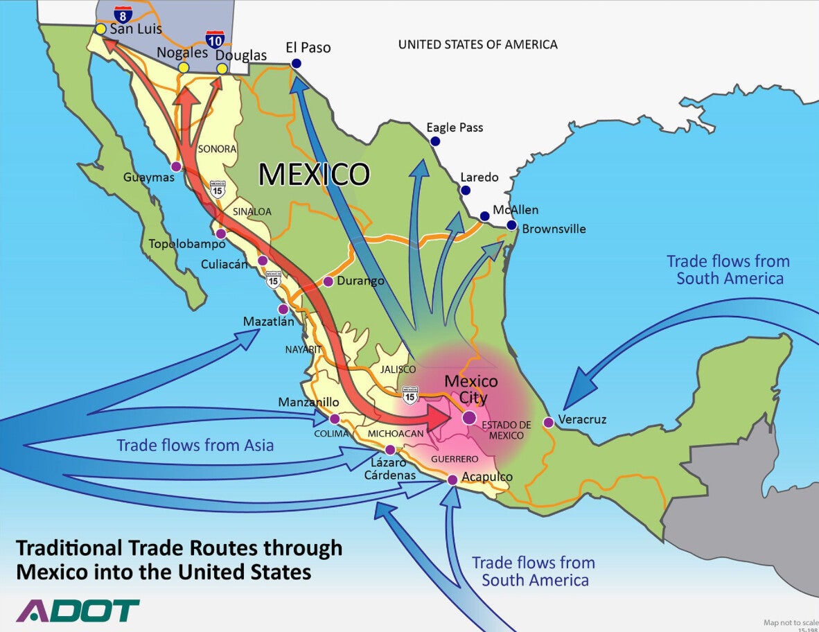
Trade Routes Through Mexico (20th Century)
This historical trade map reveals how Mexico served as a vital commercial link between North America, South America, and AAsia during the 1970s. Major oil exports moved through ports like Veracruz and Tampico, while overland connections to the U.S. fueled economic growth. These routes reflect Mexico’s ongoing role as a bridge for trade, especially in raw materials and agriculture.
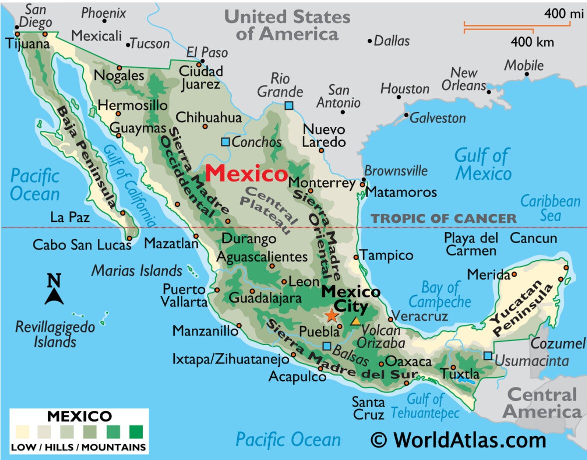
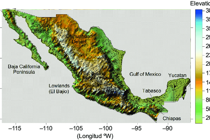
Physical Map with Latitude & Longitude
This map shows Mexico’s geographic diversity—from tropical jungles in the south to dry deserts in the north. Spanning from 14° to 32° north latitude, it crosses both tropical and temperate zones. The Sierra Madre mountain ranges and large plateau regions shape weather, farming, and even earthquake risk. Its strategic position also allows access to both the Pacific Ocean and the Gulf of Mexico.
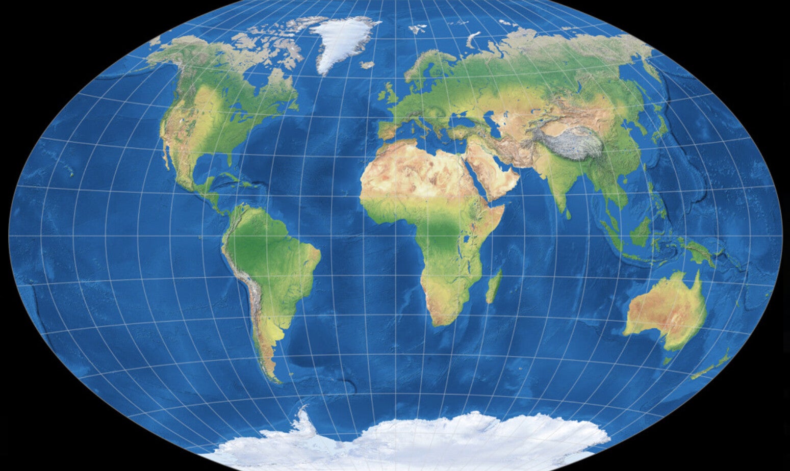
Modern World Map Using Winkel Tripel Projection
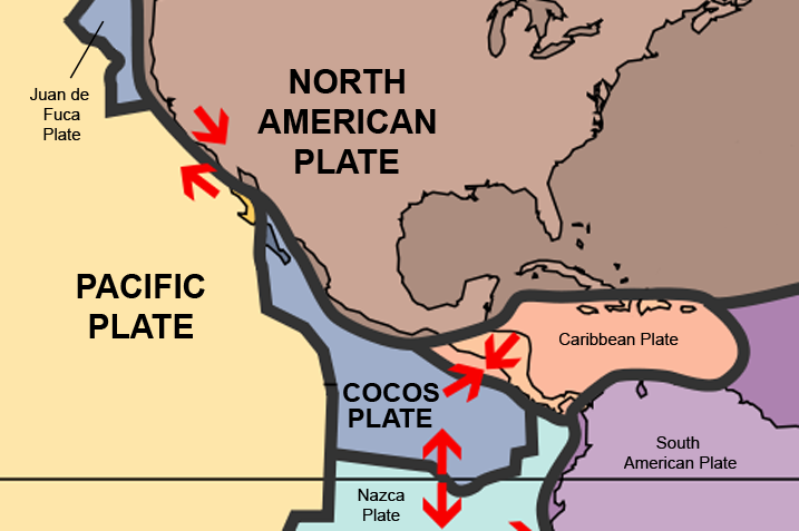
Mexico is located where the North American Plate, Cocos Plate, and Pacific Plate meet. This causes earthquakes and volcanic activity. Places like Mexico City have experienced big earthquakes in the past, and people have learned to prepare better because of that.
Volcanoes, Erosion, and Landforms
Mexico has over 40 active volcanoes. Some of the most famous ones are Popocatépetl and Colima. Over time, erosion has shaped canyons, like the Copper Canyon in Chihuahua. Mexico also has high mountains, rivers, and two long coastlines, one on the Pacific Ocean and one on the Gulf of Mexico.
Country Overview Questions
On which continent and in what general area is your country located?
Mexico is in North America, just south of the United States. It connects to Central America and borders both the Pacific Ocean and the Gulf of Mexico.
What is the latitudinal range of your country?
Mexico’s latitude ranges from about 14° N to 33° N. This means the country includes both tropical and desert climates.
During what time periods or years has your country existed?
Mexico has a long history starting with ancient civilizations like the Olmec, Maya, and Aztecs. It became a Spanish colony in the 1500s, gained independence in 1821, and has existed as the United Mexican States since then.
Are there any famous cartographers from your country or cartographers from other countries who influenced map making in your country?
One of the most famous influences in Mexican cartography was Antonio García Cubas (1832–1912). He was a Mexican geographer and historian who created detailed maps of Mexico in the 19th century. His maps included physical geography, population, and political divisions, helping people understand the country better.
Tectonic Plates and Natural Disasters
Is Mexico near tectonic plate boundaries?
Yes. Mexico sits at the meeting point of three tectonic plates: the North American Plate, Cocos Plate, and Pacific Plate. Along the west coast, the Cocos Plate subducts beneath the North American Plate, creating a convergent boundary. This zone causes strong seismic and volcanic activity, especially along the Middle America Trench.
Does your country experience natural disasters like earthquakes, volcanoes, or tsunamis?
Yes. Mexico often experiences earthquakes, especially in cities like Mexico City, Oaxaca, and Guerrero. For example, the 2017 Puebla earthquake killed over 350 people. Mexico also has volcanoes like Popocatépetl, which is still active. Tsunamis have also reached the Pacific coast after undersea earthquakes.
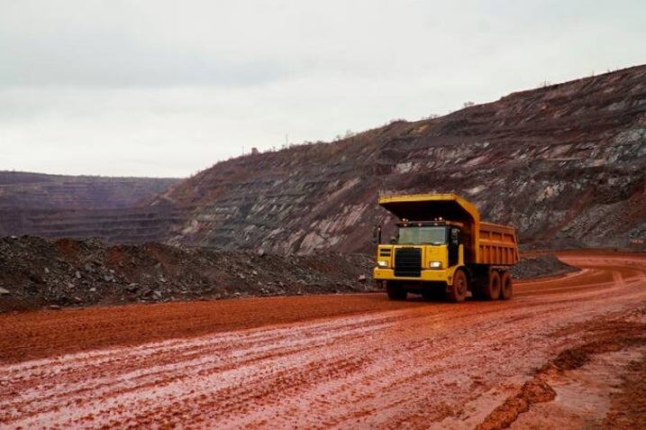
Rock and Mineral Resources
What types of rocks or minerals are found in Mexico, and how do they benefit the economy?
Mexico has large deposits of silver, gold, copper, lead, and zinc, especially in the states of Zacatecas, Sonora, and Chihuahua. It’s one of the top silver producers in the world.
How do mineral resources affect jobs and exports?
Mining creates thousands of jobs and brings in billions through exports. Silver and gold are mostly exported to the United States, Canada, and Europe.
Are there other impacts from these resources?
Yes. Mining can harm the environment, especially water sources. There are also conflicts with communities over land and pollution.
Earthquakes
Does Mexico experience significant earthquakes?
Yes. Earthquakes are common and dangerous. In 1985, an 8.0 quake hit Mexico City, killing thousands and causing huge damage. More recently, in 2017, a 7.1 quake also hit central Mexico.
What is the government doing to help citizens prepare?
Mexico has an early warning system (SASMEX) that sends alerts seconds before strong shaking begins. The government also holds earthquake drills, especially in schools and public buildings.
Mountain Ranges
Which major mountain ranges are in or near Mexico?
Mexico has three major mountain ranges:
-
The Sierra Madre Occidental (west)
-
The Sierra Madre Oriental (east)
-
The Sierra Madre del Sur (south)
They are made of folded rock and reach elevations of over 3,000 meters.
How do these mountains affect weather, water supplies, and local culture?
Mountains block rain, making some areas dry and others lush. They help form rivers and water systems. Culturally, many indigenous communities live in the mountains and keep traditional ways of life.
Did they provide protection or impact trade routes, both historically and now?
Yes. In the past, mountains protected villages and shaped trade routes. Today, they still affect how roads and railways are built.
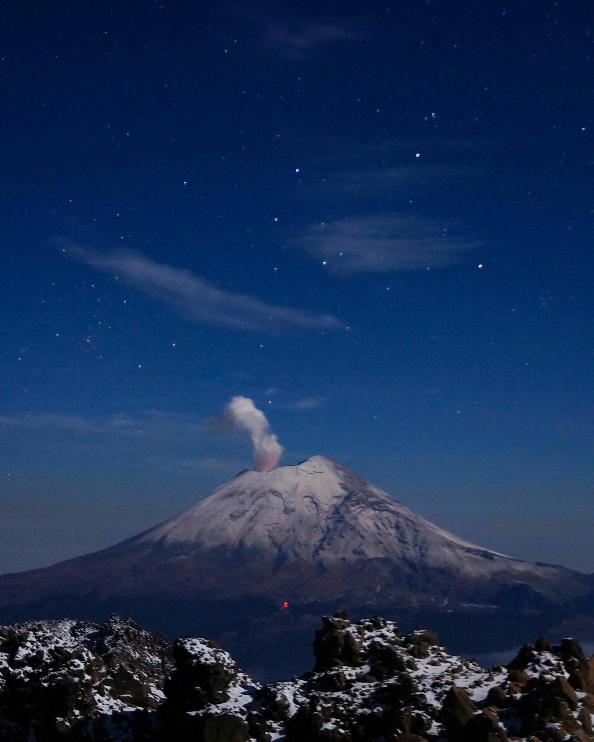
Volcanoes
Does Mexico have significant volcanoes?
Yes. Mexico has many volcanoes, including:
-
Popocatépetl (active composite volcano)
-
Colima Volcano (active)
-
Pico de Orizaba (dormant, tallest in Mexico)
How do volcanoes impact the region?
They make the soil very fertile, which helps farming. They also bring tourism. But they are also a threat—Popocatépetlhas had several recent eruptions.
Give historical examples of eruptions and their effects.
-
In 2000, Popocatépetl erupted and forced thousands to evacuate.
-
Colima has erupted several times in the last 20 years, covering towns in ash.
Explore Mexico with us
Delve into the wonders of Mexico! Discover all the best places today.
Create Your Own Website With Webador